- MTB
- Mount Cameron
Mount Cameron
HotKey Statistics
- State Forest
- Conservation Area
- Regional Reserve
Location
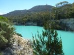
I'm breaking the rules on this one and listing a track provided by Forestry Tasmania that I haven't ridden. What I can tell you is this circuit is legal, that it appears to be mainly on gravel roads and fire trails and that it circumnavigates Mount Cameron in the North East of the State. The recommended starting point on the map provided by Forestry Tasmania is the Scottsdale High School Mount Cameron Field Study Centre (or more specifically the Field Centre Gate) but I could also recommend starting at Little Blue Lake just north of Pioneer on Gladstone Road (B52) for those who don't want to do the extra driving to the Field Centre.
GETTING THERE
To get to the Mount Gladstone Field Centre, if coming from Launceston or Scottsdale, turn right at Bridport and head towards Gladstone. After about half an hour, the sealed road changes to gravel, coinciding with the Banca Road junction. Continue towards Gladstone for 8.5 kms where you turn right onto another unsigned gravel road (the Old Port Road). Travel a further 6.9kms along this road, without turning off, to a Y-junction. Turn left at this junction and travel a further 2.9kms to a boom gate. There is a small parking area at the gate. The Field Study Centre is a further 1.7kms past the gate. If you are coming from Gladstone, turn left at the petrol station and head towards Bridport. Turn left onto the Old Port Road after about 10kms.
Little Blue Lake, is on the Gladstone Highway (B52). It is 8km south of Gladstone and 10km north of Pioneer. Little Blue Lake is signed and there is a parking area next to the lake.
FACILITIES
No facilities on this route. Nearest towns are Gladstone (limited facilities), Derby and Bridport.
ROUTE OPTIONS
If you are interested in climbing (walking) to the top of Mt Cameron, then the best information I've found on the walking track is here on Bushwalk Australia. It appears to be a 3-5 hour walk starting at the Mount Cameron Field Study Centre which could be a good reason to take FT's advice and start your ride there.
WARNINGS
I've not ridden this trail but it is reasonable to expect it to be lightly used and remote so plan your visit accordingly.
There are some creek washouts on the northern firebreak track.
The route below and gpx are desktop quality only (ie. I've tried to discern the path as best I could using the 1:25:000 series tasmaps and Google Earth, but have not ground truthed the maps. The section above Blue Lake in particular was just guess work on my part.
ROUTE DETAILS
See Forestry Tasmania route map link at the bottom of this page. Advice I have received is to ride it in an anti-clockwise direction.
Map
Editor review
if you want to see the lake probably start on that side of the trail lol. (because i didnt make it lol)
Review
User reviews
Highly suggested.
-from Scamander
Highly suggest looking around Scamander too :)
Review

-
{{#owner}}
-
{{#url}}
{{#avatarSrc}}
{{name}} {{/url}} {{^url}} {{#avatar}} {{& avatar}} {{/avatar}} {{name}} {{/url}} - {{/owner}} {{#created}}
- {{created}} {{/created}}


