Rokeby to Lauderdale Trail Survey
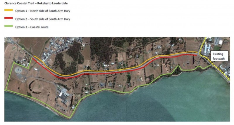
The Clarence Tracks and Trails Action Plan identifies future trails to complete gaps and to create an integrated network of tracks through bushland and coastal areas. One of the projects identified is a track between Rokeby and Lauderdale.
 A survey is being carried out to determine the likely numbers of people who would use the track and a preferred alignment, either alongside the South Arm Highway or along the shoreline of Ralphs Bay. Your feedback will assist with future planning for this project.
If you would like to complete the survey you can do so by:
Click here to complete the survey online, or
In the foyer of the Council Offices 38 Bligh Street, Rosny Park, complete the survey form and drop it in the box provided.
Closing date for submissions is 27 March 2015.
Stay Informed
When you subscribe to the blog, we will send you an e-mail when there are new updates on the site so you wouldn't miss them.
About the author
Comments
No comments made yet. Be the first to submit a comment